With the help of this program you can create maps for several mobile and desktop applications. It is possible to edit the atlas on different zoom levels.
Mobile Atlas Creator
ver. 2.2.3.2
14,4 Mb (downloads: 11)
Update date:
09.08.2022
Developer:
Open source
Windows version:
Windows XP, Windows Vista, Windows 7, Windows 8, Windows 8.1, Windows 10
Mobile Atlas Creator is a Windows tool for adapting atlases to a wide variety of navigation devices. Source maps are included with the app.
How it works
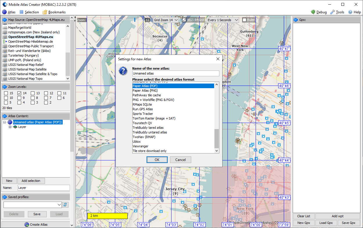
To begin the process users can click Atlas – New Atlas in the upper left corner of the main window. The next step is to choose the desired map type from the comprehensive list. There are atlases for TomTom, Garmin, Magellan and many other popular devices. Moreover, it is possible to create layouts for printing paper maps. Saving as a PDF for viewing in Adobe Reader is available as well.
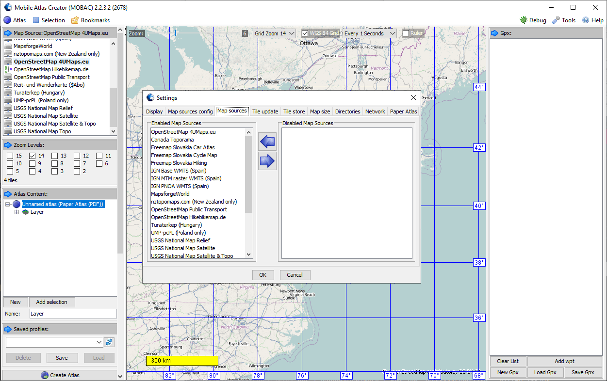
After selecting the destination device type, you can load any map from the list on the left side. OpenstreetMap, USGS National Map and several other sources are provided with the tool.
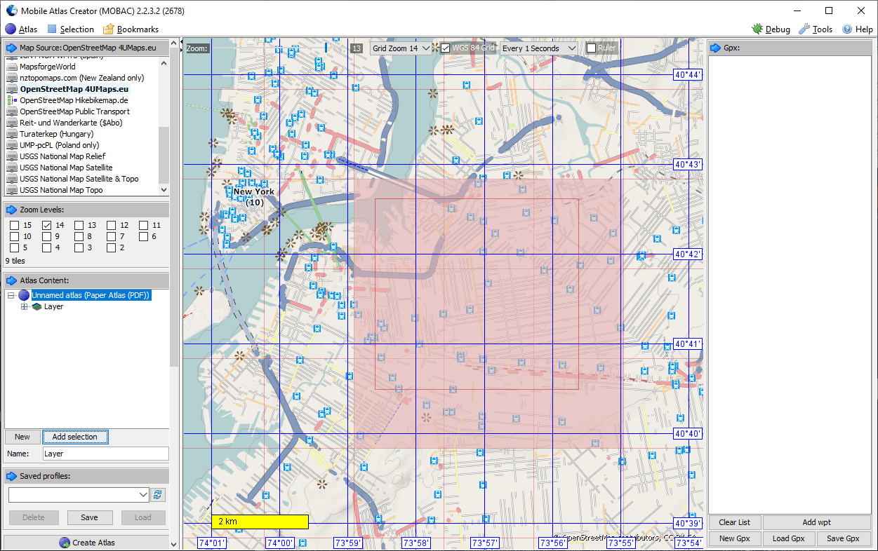
When the map is loaded, it is possible to zoom to the desired location and select the area for the new atlas. Helpful instruments like Grid and Ruler are located at the top of the map screen. You can press the Add selection button to add the marked region to the project.
The final step is choosing one or more zoom levels to be included in the atlas. You can select them by clicking on the corresponding tick boxes on the left. It is worth mentioning that additional levels can significantly increase the final size of your project.
Extensive manual with details about supported devices and their functions is included with the utility.
Additional options
In the Settings menu you can specify the destination directory for the atlases. It is possible to define the parameters for updating existing sources and load the new maps into Mobile Atlas Creator.
Metric and Imperial unit systems for the map scale bar are supported. There are settings for the type, size and color of the font that will be used in your project.
Features
- free to download and use;
- helps you create maps for different mobile devices;
- works with modern versions of Windows;
- there is an option to save the atlas as a PDF;
- including several zoom levels is possible.
14,4 Mb (downloads: 11)