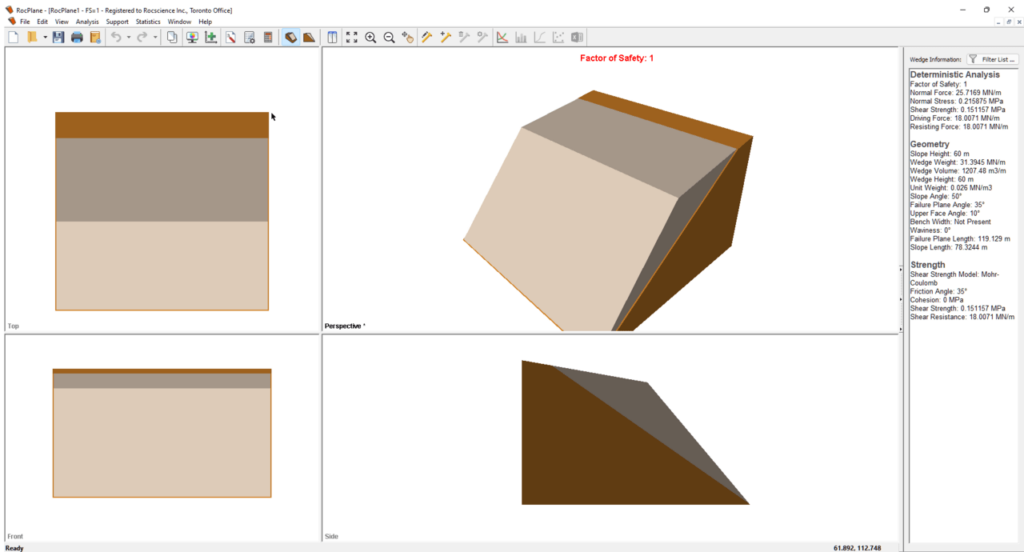
With the help of this advanced utility, users can model rock structures and assess their safety. Additionally, there is support for creating comprehensive reports.
RocPlane
RocPlane is a specialized program for Windows intended to address the intricate challenges of analyzing rock slope stability. This computer instrument is widely used by geotechnical engineers, mining professionals, and geologists to assess the safety of environmental structures.
Design models
The software provides a reliable workspace that enables you to define slope geometry, material properties, and boundary conditions using graphical tools. There is support for a wide range of failure criteria, including Hoek-Brown, Mohr-Coulomb, and more.
It is worth noting that the utility employs sophisticated algorithms to automatically search for critical slip surfaces within the rock mass. This feature helps you to quickly identify potential failure modes and evaluate the stability of the slope.
Data visualization
When it comes to processing the results, you can visualize data in both 2D and 3D space. Thus, you are able to understand the spatial distribution of factors influencing stability, such as stress, displacement, and many others. To work with topology data, you may try another app called MapInfo Professional.
The program is also capable of generating comprehensive reports that provide clear insights into the analysis results. These documents may aid you in communicating findings to stakeholders and business partners.
Features
- free to download and use;
- compatible with modern Windows versions;
- allows you to perform rock slope stability analysis;
- you can visualize data and detailed generate reports;
- there is an option to batch computer model files.

