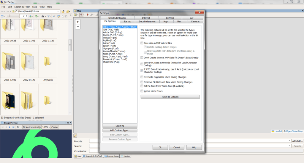
This app is designed to change the shooting coordinates. Thanks to this utility, it is possible to add GPS information to a photo. There is also a metadata editor.
GeoSetter
GeoSetter is a utility for Windows that offers you to edit metadata of various images. Thus, it is possible to add location information to the pictures. There is an option to specify a point on the map. All data is recorded using ExifTool tools.
File Import
On the left side of the home page, you can find a file manager that helps you choose a folder to import photos. The program supports popular formats, including RAW, TIFF, JPG, and more. You may also obtain additional information about the image, such as the size, title, resolution, etc.
Geodata
This utility enables users to add location information to the metadata of their images. To proceed, it is necessary to select an image and specify a point on the map. Then, the app will then determine the coordinates. Moreover, there is a feature to save locations in Favorites.
You may automatically fill in IPTC fields and the altitude value above sea level. Please note that an internet connection is required to obtain this data. Upon editing, it is possible to create a copy of the original image or overwrite the file.
Editor
You can edit other metadata, besides the coordinates. To be specific, you may change the object and author’s name, date of capture, description, title, keywords, and more.
Features
- designed for editing image metadata.
- users can specify the coordinates of the shooting location;
- integration with Google Maps is supported;
- free to download and use;
- compatible with modern Windows versions.

